
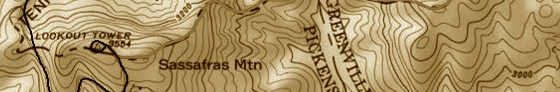
SASSAFRAS MOUNTAIN WITH AN ELEVATION OF 1,083 M (3,554 FT) IS THE TALLEST MOUNTAIN IN THE STATE OF SOUTH CAROLINA, USA. IT IS LOCATED IN THE BLUE RIDGE MOUNTAINS, PART OF THE APPALACHIAN MOUNTAINS, AT THE BORDER BETWEEN TWO STATES: SOUTH CAROLINA AND NORTH CAROLINA.
The summit is a relatively easy hike starting right away from the parking lot all the year round, and is, additionally, handicap accessible, even though the path may be rather steep at times. As for the climbing routes, the variety is almost endless.
The Pisgah Quadrangle topographical map, dating back to 1904-1905, depicts the long abandoned Sassafras Gap Road that served as the main route until the end of the 19th Century. This old road is a short distance from the peak and is crossed by the hiking trails. Most people crossing this abandoned path don't recognize it used to be ab actual road. A hike southward down the old Sassafras Gap Road leads to Hickory Head Spring, the source of the South Saluda River.
THE FIVE HIGHEST PEAKS IN SOUTH CAROLINA:
- Sassafras Mountain - 1,083 m (3,554 ft), at the border between South Carolina and North Carolina, in Pickens County, South Carolina, United States.
- Pinnacle Mountain - 1,041 m (3,415 ft), in Pickens County, South Carolina, United States.
- Coldbranch Mountain - 1,016 m (3,333 ft), in Greenville County, South Carolina, United States.
- Fork Mountain - 1,004 m (3,294 ft), in Oconee County, South Carolina, United States.
- Hogback Mountain - 972 m (3,189 ft), in Greenville County, South Carolina, United States.

LATEST BLOG POSTS
I quit the rat-race to live a more adventurous life. This is my journey.