
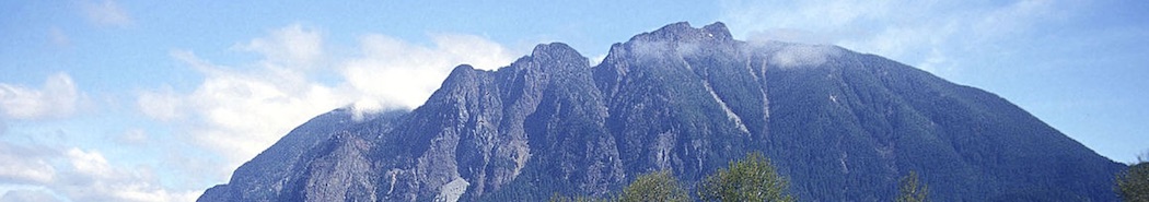
MOUNT SI IS THE MOST VISITED MOUNTAIN IN The ENTIRE STATE OF WASHINGTON. IT ASTONISHES WITH THE GREEN OF THE TREES, THE GREY OF THE ROCKS AND THE WHITE OF THE SNOW SITTING ON THE TOP OF THE MOUNTAIN.
Name: Mount Si
Height: 1,270 m (4,167 ft)
Location: in North Bend, Washington, USA
First Climbed: unknown
Climb Time: 5-7 hours
Best Time to Climb: April – November (it is climbed all year round)
In the legends of a local Native American tribe, Mount Si is considered to be a body of the moon, fallen to the Earth after chasing the fox and the blue jay. Considering its grand looks, there is no surprise that Mount Si was given its own tale.
Despite the fact that it does not come close to elevation of Washington’s tallest Mount Rainer – 4,394 m (14,417 ft), Mount Si, with an estimated 80,000 to 100,000 annual visitors, is arguably the most heavily climbed trail in the entire state.
Mount Si is located on the western margin of the Cascade Range, nearby the town of North Bend. The mountain is named after a local homesteader Josiah Merritt, known as "Uncle Si" who first built a cabin at the base of the peak in 1862.
Mount Si became recognisable after it had been featured in hit TV series – Twin Peaks, which was filmed in North Bend. A shot of the mountain even appeared in opening credits of the show as its looks suited perfectly to the mysterious theme of the series.
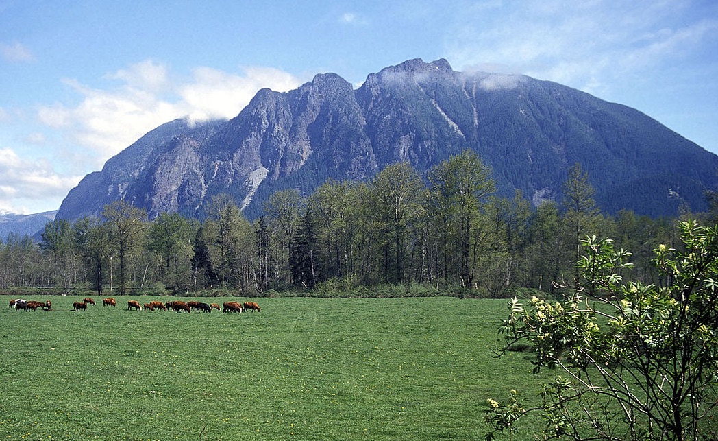
Photo by Mountains to Sound Greenway Trust
CLIMBING MOUNT SI.
The trail begins at an altitude of approximately 213 m (700 ft), it ascends steadily and gently, for over a mile and flattens out once you arrive at Snag Flat at an altitude of 640 m (2,100 ft), where visitors are given the opportunity to admire old-grown trees, that had survived both fire and logging.
From Snag Flat the trail steepens, climbing becomes more challenging. It is additional 549 m (1,800 ft) to reach the Haystack Basin at the elevation of 1,189 m (3,900 ft). Once you make it there, views of the Snoqualmie Valley and Olympia open up and on a sunny day you even get a good view of Seattle.
Even though the trail does not end at the Haystack Basin, most do not continue to the top, even though it is only around 110 m (360 ft) away. As scrambling to the summit on a rocky and steep path is not only challenging but also life threatening, most decide not to bother.
TREKKING AROUND MOUNT SI.
There are quite a few different trails to walk around the area. First of all, there is Little Si – 3,7 mile trail, located just next to Mount Si. Even though the walk is easier with less elevation, it is not lesser than its big sister, as visitors are welcomed with breath-taking views of Snoqualmie Valley and Rattlesnake Mountain at the top.
Another walk worth taking – Tenerife (Kamikaze) Falls trail. There are, actually, two paths that lead to the same waterfall – 12 km (7,5 mi) trail rated difficult and 9,3 km (5,8 mi) one rated moderate.
Other than mentioned above, there are a number of different trails worth checking out, rating from easy to moderate difficulty, including Boulder Garden and Talus loops, CCC and Tanner trails.